
American Spirit
20 Acres
Gold Claim on the Dolores River
$8,750
Strike Gold on the Dolores River
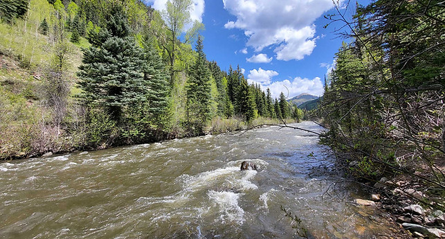
In the heart of the rugged San Juan Mountains, nestled between alpine meadows, dense forests, and historic mining towns, flows the legendary Dolores River—a river that has carried gold through its gravels for centuries. South of the historic mining town of Rico, Colorado, lies a stretch of this river that remains one of the most promising placer gold regions in the state.


Topographic map showing location of American Spirit.
Rich Gold History Meets Modern Opportunity
The Dolores River flows through one of the most geologically rich regions in the American West. Just upstream lies Rico, a historic mining boomtown established in the 1870s during Colorado’s silver and gold rush. The region’s lodes have produced millions of dollars in precious metals, and the same mineralized veins that supplied those historic hard rock mines continue to shed placer gold into the Dolores River system.
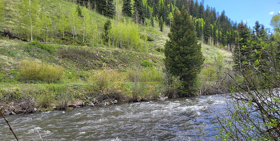
South of Rico, the river winds through wild, relatively untouched terrain—terrain that still holds placer gold deposits in its gravel bars, banks, and tributaries. Modern tools, techniques, and geological knowledge make this a prime location for serious recreational prospectors and small-scale miners.
Geological Setting
The river originates in the high-altitude terrain of the San Juan Mountains, an area shaped by intense volcanic and hydrothermal activity during the Tertiary period. This activity led to the formation of a variety of mineral deposits, including:
-
Epithermal vein systems containing gold, silver, and other base metals.
-
Lode gold deposits that eroded over time, releasing gold particles into surrounding streams and rivers.
As the Dolores River flows through these mineralized zones, it naturally concentrates gold and other heavy minerals into its alluvial gravels, forming placer deposits
Placer Deposit Formation
Placer gold accumulates due to the mechanical weathering and erosion of lode sources. The key features supporting placer deposit formation in the Dolores River include:
-
High-energy river dynamics: Seasonal snowmelt and rainfall events lead to strong currents capable of transporting and concentrating dense minerals like gold.
-
Natural traps: Meanders, inside bends, bedrock outcrops, and gravel bars serve as natural collection points where heavier materials settle.
-
Proximity to lode sources: The presence of upstream historic gold mines and exposed mineral veins increases the likelihood of sustained replenishment of gold into the river system.
Geological Reports: Dolores River Gold Deposits

American Spirit on the Upper Dolores
American Spirit is located in Section 11, T39N, R11W, on the Dolores River. A 20 acre claim located within the Rico District Placer Belt - a prime location for prospecting. Numerous reports issued by the USGS and Colorado Geological Survey, as well as other published geographical materials, highlight this area for placer gold potential.

Colorado Geological Survey Publication
Map from Colorado Geological Survey publication, "Gold Panning and Placering in Colorado, How and Where". Showing Southwest Colorado Placers. The Colorado Geological Survey discusses the Dolores River south of Rico, CO: "There are placers along the Dolores River from the mouth of Burnett Gulch..."

U.S. Geological Survey Report
Map from the U.S. Geological Survey publication, "Mineral Resource Potential and Geology of the SJNF". Showing areas favorable for placer gold deposits. "The known Au-bearing placers in the Forest are (K1) the upper Dolores River placers downstream from the Rico mining district..."
.jpg)
NM Geological Society Conference
Map from NM Geological Society-Nineteenth Field Conference publication. "The placer deposits near Rico and at Baker's Bridge contain some unworked gravels of good grade. Those near Rico may be worked in the future by small-scale methods..."

Rico Mining District, Colorado ("5")
Map from the U.S. Geological Survey publication, "Mineral Resource Potential and Geology of the SJNF". The district has produced about 83,000 ounces of gold, 14.5 million ounces of silver, along with copper, lead, and zinc.
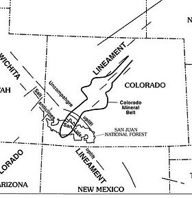
Colorado Mineral Belt
The Dolores River sits within the southwestern Colorado segment of the Colorado Mineral Belt- an ore-rich zone shaped by Laramide and younger magmatic activity, generating numerous igneous intrusions and precious metal deposits.
Quick Facts
BLM Serial Number
TBD
Elevation
8,773 feet
Acres
20
Claim Type
Unpatented Placer Claim
County
Dolores County
Mining District
Rico
Commodities
Gold
Land Type
River Bank / Terrace
Legal Land Description
W1/2NW1/4SE1/4, Section 11, T39N, R11W
Access
Road access via Colorado Highway 145
GPS
-
NW: 37.6587394, -108.0421135
-
SW: 37.6551388, -108.042139
-
SE: 37.6552024, -108.0398608
-
NE: 37.6588058, -108.0398352
Recreation
The historic town of Rico—a “slice of paradise” perched along the Dolores River—serves as the gateway to a wildlife-rich playground that spans four seasons.
River & Reservoir Fishing
-
The Dolores River is renowned for its brown trout, cutthroat, cutbow, and rainbow trout as well. Below McPhee Reservoir is a hotspot for big trout in bigger numbers, while the more rugged headwaters above Rico are ideal for targeting wild cutthroats in serenity.
-
Nearby lakes like Alta Lakes and Groundhog Lake are prime spots for rainbow, brown, and even cutthroat trout.
Horseback Riding, OHV & Camping
-
Gentle valley paths and far‑reaching sanctuary forests invite horseback rides, while multiple OHV-accessible roads beckon OHV/ATV adventurers—all within San Juan’s boundaries.
-
Rustic campsites dot the region: enjoy lakeside evenings, roaring rivers, and the open sky—ideal for hikers, bikers, and families alike.
Alpine Hiking & Backpacking
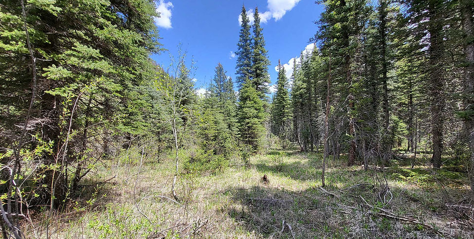
Hikers can immerse themselves in a wild blend of spruce‑fir forests, rugged canyons, and riverside meadows. The Bear Creek Trail (#607) begins where the creek meets the river—winding through aspens and spruce over a peaceful 4–8 mile out‑and‑back route. Another standout is the abandoned Rio Grande Southern (RGS) River Trail, a 4.7‑mile peaceful rail‑grade walk that hugs the river corridor through scenic canyon valleys. For a more challenging alpine outing, try the nearby Calico National Recreation Trail—an intermediate trail around 5.5 miles long with high‑elevation ridgelines above 10,000 ft, offering vistas of the Dolores valley and San Juan Mountains.
Mountain Biking & Scenic Drives
-
Rico lies amid high alpine biking routes winding through the San Juan National Forest, part of a network boasting thousands of miles of trails for every rider’s skill level.
-
Prefer wheels on pavement? The iconic San Juan Skyway Scenic Byway passes through Rico, climbing over scenic Lizard Head Pass with sweeping vistas of Telluride, Ouray, and Silverton.
Prime Big‑Game Territory
-
Colorado Unit 71 spans over 520 sq mi, featuring elevations from 7,000 to 14,160 feet and approximately 84% public land: ideal for backcountry elk and deer hunts.
Winter Sports & Snow Adventures
-
Backcountry skiing, snowshoeing, and cross‑country adventures are readily accessible in winter’s wake, with access to both San Juan and Uncompahgre National Forests.
-
For snowmobiling and Nordic ski rentals, numerous outfitters cater to winter explorers – from gentle forest trails to deep snow expanses.
Historic & Cultural Gems
-
Discover Rico's Victorian‑era charm: the Historic Courthouse, William Kauffman House (circa 1891), and old mercantile buildings offer a rich look into an 1880s silver‑boom mining town.
-
Visit the Rico Historical Museum, stroll antique shops, or unwind in the local Prospector Bar & Grill—experiencing the town’s laid‑back, authentic vibe.
Seasonal Highlights & Day Trip Ideas
-
Summer (July–Aug): Peak wildflower blooms, forest backpacking, angling, and endless bike-touring through emerald valleys.
-
Fall: Aspen forests glow in gold and orange, perfect for hiking and scenic photography—especially along the Skyway corridor.
-
Winter: Powdery slopes await backcountry skiers, snowmobilers, and cross-country enthusiasts.
-
Spring: Fishing kicks off early; high meadows bloom late into June, ideal for quieter getaways.
Gold Prices Are High—And Still Rising
With the price of gold regularly topping $3,300 per ounce, placer mining is no longer just a hobby—it’s a potentially profitable endeavor. As inflation persists and global instability rattles financial markets, gold continues to shine as a reliable store of value.
That means:
-
Your gold finds are worth more than ever.
-
A productive claim becomes a valuable investment.
-
Demand for gold-rich properties is growing, making claims a resalable asset.
True Ownership Under the 1872 Mining Law
When you purchase a properly filed and maintained placer mining claim, you're not just leasing access or getting permission—you’re securing exclusive mineral rights under the General Mining Law of 1872, still in full force today. This law guarantees U.S. citizens the right to explore and extract minerals on public lands, and it gives claim holders powerful protections:
-
Exclusive Rights to Gold and Other Minerals: Only the claim holder can mine and remove valuable minerals.
-
Generational Asset: A claim can be passed down, sold, or leased—creating a family legacy.
Click "Buy Now" to pay by credit card, PayPal, Apple Pay, Klarma, or Affirm.
Contact Us to arrange payment by Zelle, ACH, check, or Cryptocurrency.